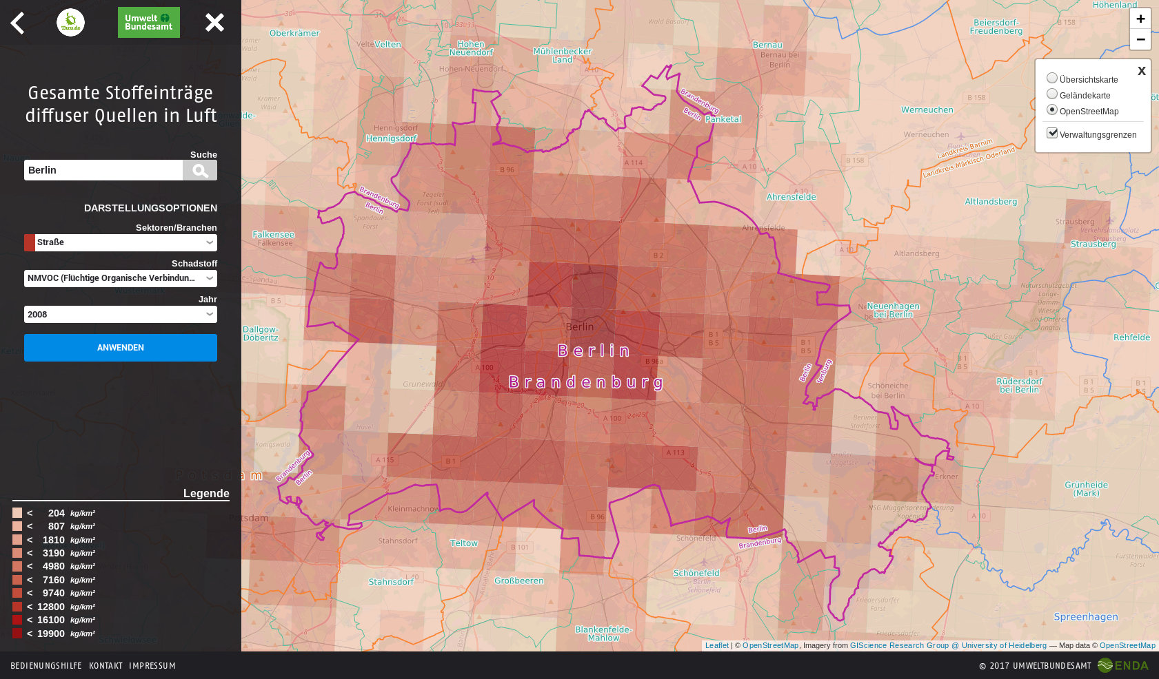
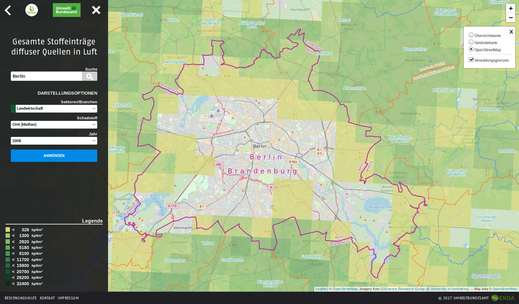
Diffuse sources are the numerous small and distributed, often mobile sources from which different pollutants are released into the environmental compartments air, water and soil. On behalf of the Federal Environment Agency we have developed an interactive map view. Through this, a distribution of the pollutants is visualized throughout Germany. The emission data are displayed in kg/km2 with a grid of 3x3km2. The map can be viewed for all at: diffuse-quellen.de
The following display options are currently offered for the medium air:
- Sectors/Industries: Inland navigation, households, agriculture, rail, road
- related pollutants (e.g. CO, CO2, NOX etc.)
- the respective available reporting years
Diffuse sources Agriculture (CH4)

Diffuse Sources Road (NMVOC)

Progress
The application was mainly developed with JavaScript (JS), the Leaflet library and HTML5. Despite the high data volume, the map display is fluid. The JS library D3 is used for rendering the SVGs and other graphics.
ENDA is currently developing the presentation of diffuse emissions to water, the data of which are now available. For the representation no tiles, but the water catchment areas (approx. 2700 in Germany) are used.